|
Geomatic
Surveyors Limited |
|||||||||||||||
| Home Page | 3D Laser Scanning | Projects | Photos | Contact Us | |||||||||||||||
Images from our Scanning Projects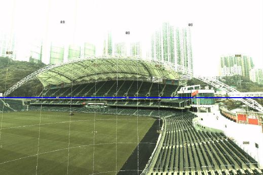 Hong Kong Stadium 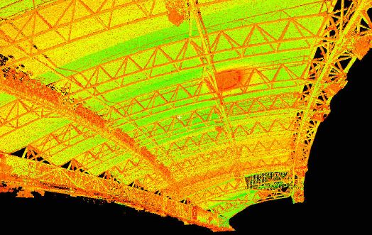 3D Laser Scanning - Hong Kong Stadium 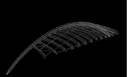 Isometric view of Steel fram drawing 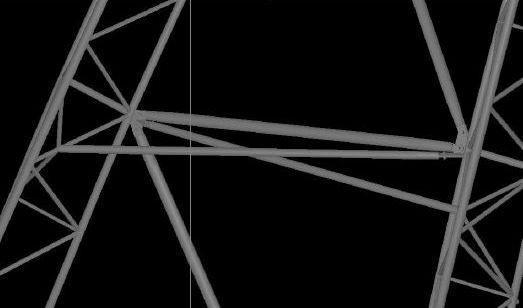 The detail view of steel frame drawing
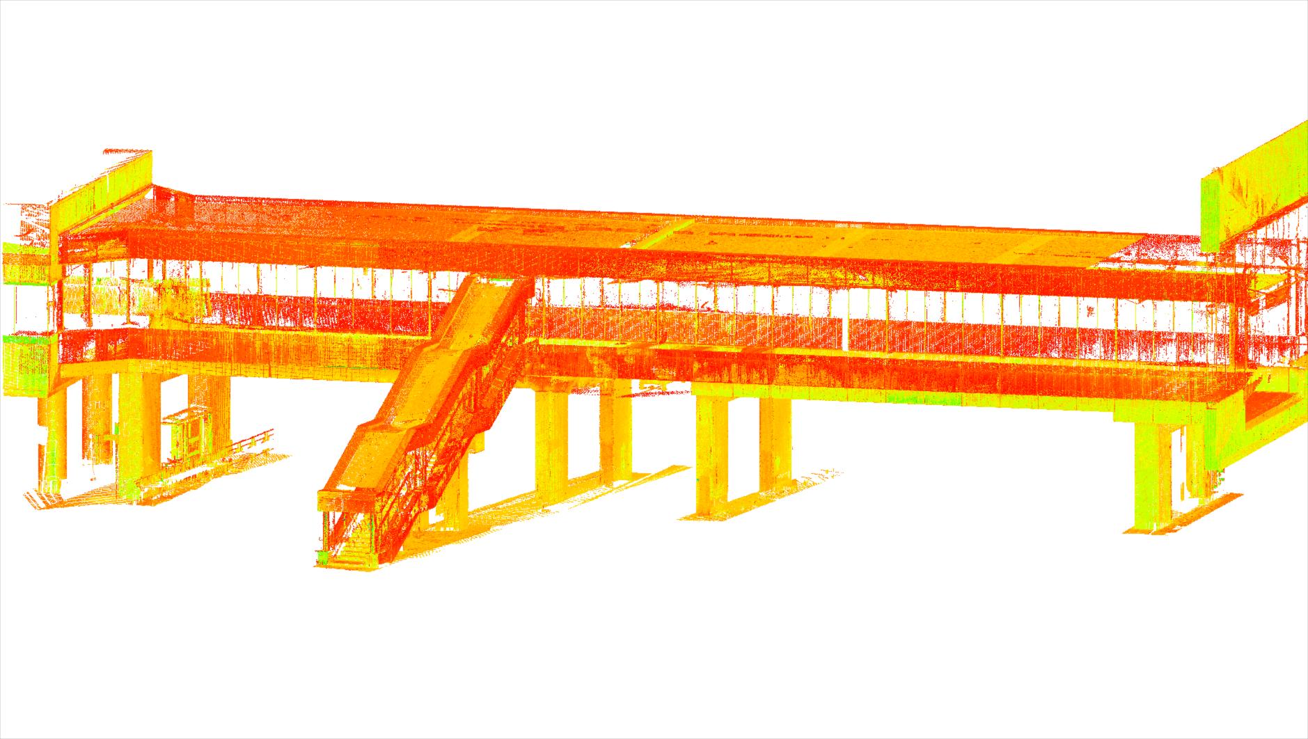
3D scan of Queensway Footbridge
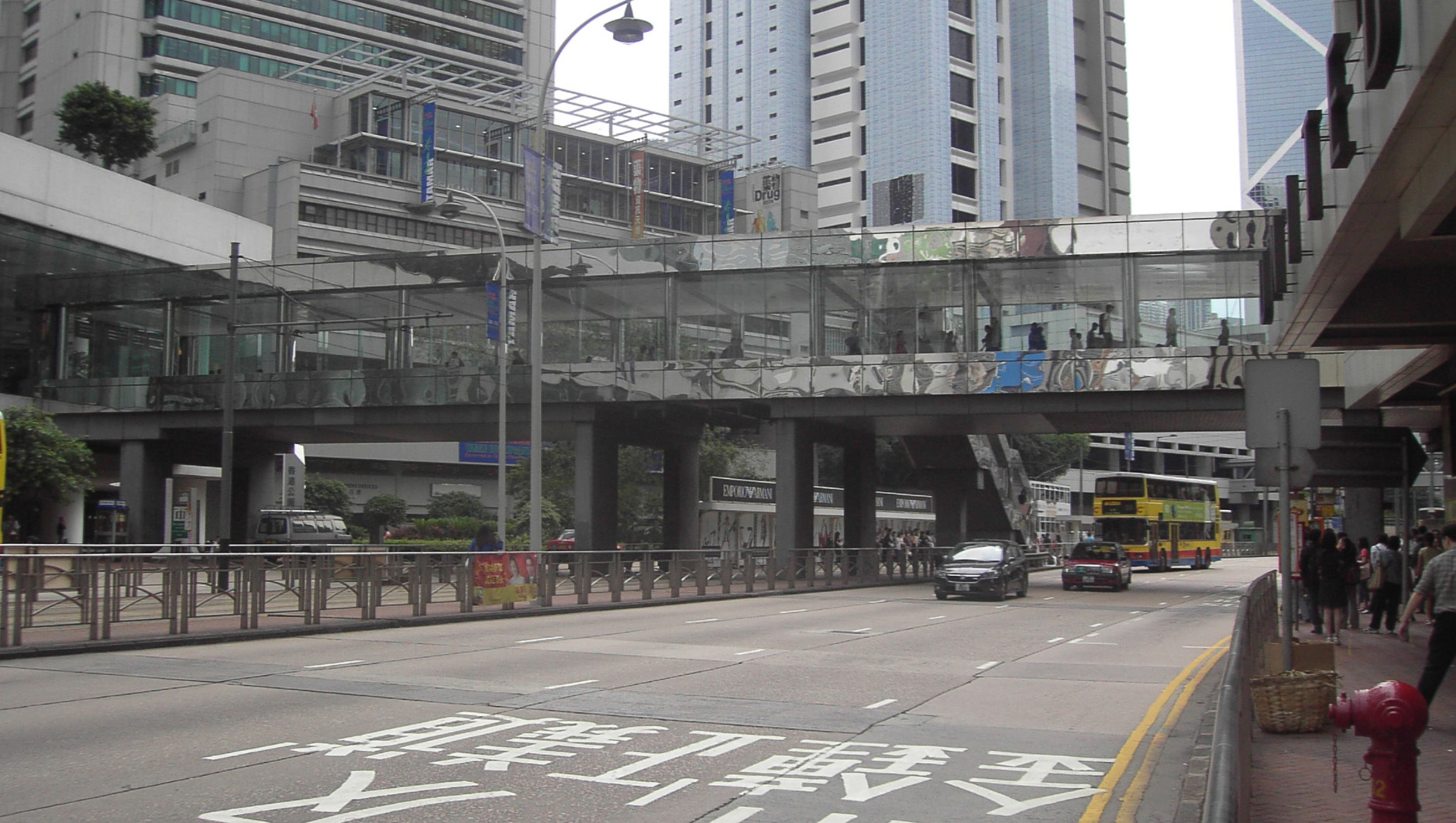
Photograph of Queensway Footbridge
If you would like to learn more about our scanning projects, click here to download our 'project case studies' You can also download and print our Presentation Brochure for your easy reference...
|
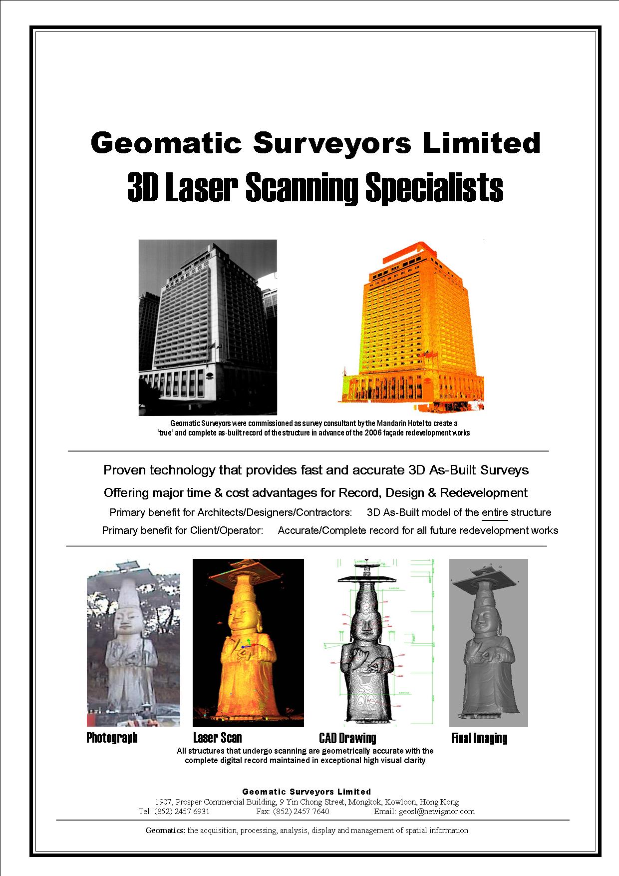
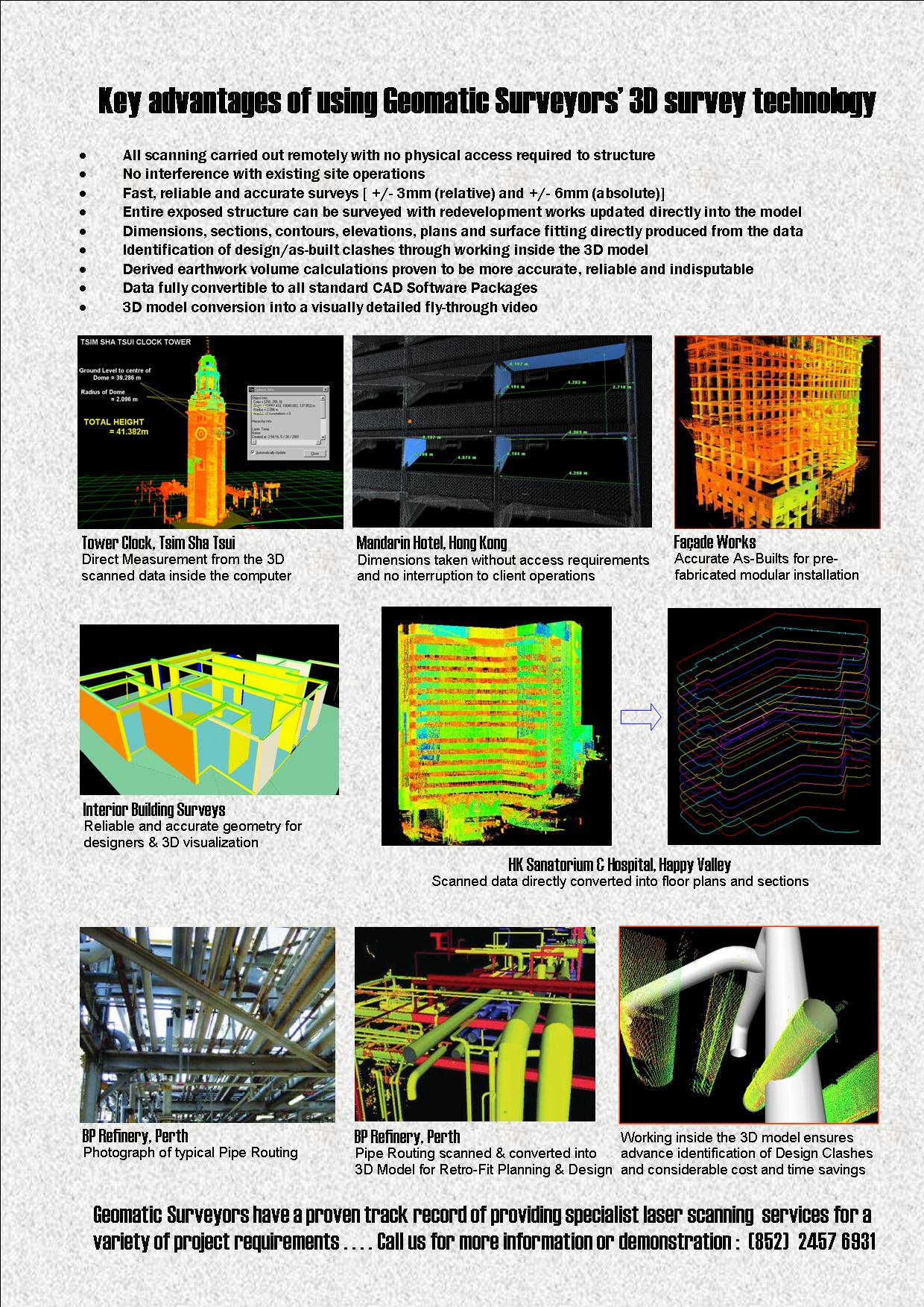
3D Laser Scanning 3D laser scanning is the rapid data capture of as-built structures, often structures that are complex and difficult to access. The scanning process is quick, unobtrusive, remote and highly accurate. A 3-dimensional model is immediately created into the on site computer and available for client use the next day. Clear Benefits of Laser Scanning
Brief Description of the On Site Process The scanner is tripod mounted and orientated towards the structure requiring scanning. An internal camera displays the area to be scanned on the operator's notebook computer and the area for survey is delimited on the computer. Each scan can be completed in minutes, with multiple scans recorded combined inside the computer to build up an entire 3D model of the structure. With the digital data successfully collected the user is offered unrivalled accuracy and detail for recording and design purposes.. The scanned data is collected in the form of dense point clouds with each measured point having a known X,Y,Z position. Distances and directions can be measured point to point, from which structural and cross sectional plans can be generated. 3D models and computer fly through animation can also be generated. This relatively new technology
is particularly ideal for complex and difficult to reach structures, providing
accurate and timely as-built surveys. Typical business sectors that can
benefit are;
The scanner avoids costly and time delaying design interferences, accurate fabrication analysis and construction path planning. If any on site dimension is required by the designer, there is no need for repeat survey works, the scan offers all dimensions recorded accurately and with total confidence. 3D Laser Scanning offers the client complete peace of mind that the entire structure has been accurately and totally recorded for all design and measurement purposes. Outline Technical details Laser
Type Class
II (Eye Safe)
|
||||||||||||||
|
Home | 3D Laser Scanning | Projects | Photos | Contact Us |
|||||||||||||||
| Geomatic Surveyors Limited 2013 | |||||||||||||||
 |
|
||||||||||||||